
Check real-time beach conditions across Quintana Roo before planning your day. Find the perfect beach today!
Status Badge / Alert: 🟢 Sargassum Today: Low / Moderate in the Riviera Maya (Recently updated)
Interactive Real-Time Beach Map
Click on the camera icons on the map to watch live streams of each beach, check current sargassum levels, and view local weather conditions.
Sargassum on the beach? Open waters are waiting for you!
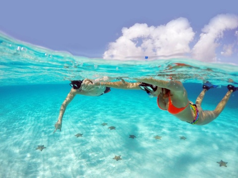
While the shoreline takes a rest, the open reef and nearby islands offer crystal-clear waters. Enjoy the Caribbean hassle-free by sailing on a catamaran, snorkeling in protected reefs, or swimming in sacred cenotes.


Preguntas Frecuentes (FAQs)
The live video streams are active 24/7 in real time, allowing you to check sargassum conditions and wind status instantly.
Sargassum movement shifts constantly with wind and ocean currents. If a beach has buildup, we recommend heading to sheltered areas, visiting west-facing islands like Cozumel or Isla Mujeres, exploring cenotes, or booking a boat tour to open water reefs.
La temporada de sargazo suele registrarse entre los meses de abril y agosto, aunque varía cada año según las corrientes marinas y los vientos. Con Playa Monitor The sargassum season typically spans from April through August, though it varies each year based on currents and weather. With Playa Monitor, you can check in real time which beaches remain clear at any time of the year.
No. Sargassum primarily accumulates along the shoreline due to onshore winds. Just a short distance offshore, the water remains crystal clear, so catamaran excursions, reef snorkeling tours, and island trips operate normally.
Check the status indicator and live webcam feed for that specific location on our interactive map. If the shoreline appears clear and has a green or yellow status, the beach is in great condition for a swim.


